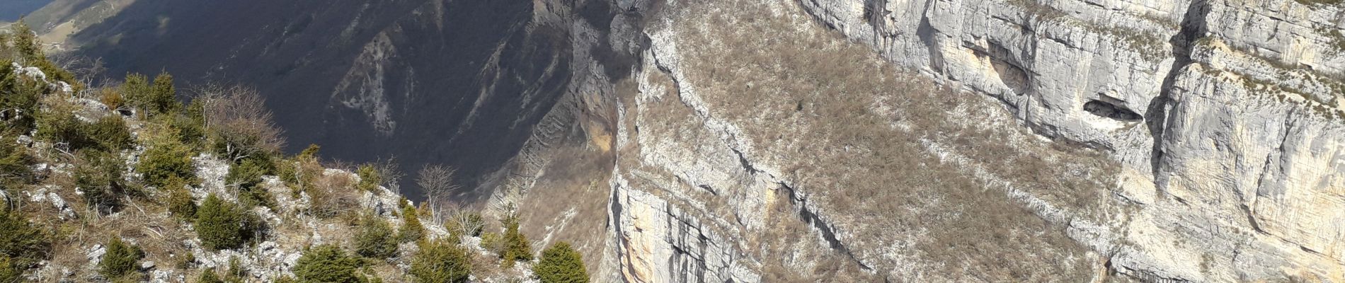
belvédère du Revoulat

MarcVachet
User
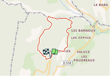

Length
6.6 km

Max alt
1171 m

Uphill gradient
378 m
Km-Effort
11.7 km

Min alt
842 m

Downhill gradient
389 m
Boucle
Yes
Creation date :
2020-03-07 09:49:38.057
Updated on :
2020-03-25 15:09:49.823
2h36
Difficulty : Easy

FREE GPS app for hiking
 SityTrail
IGN / Geographical institutes
SityTrail Plus
The world is yours!
About
Trail Walking of 6.6 km to be discovered at Auvergne-Rhône-Alpes, Drôme, La Chapelle-en-Vercors. This trail is proposed by MarcVachet.
Description
marche
Photos

Positioning
Country:
France
Region :
Auvergne-Rhône-Alpes
Department/Province :
Drôme
Municipality :
La Chapelle-en-Vercors
Location:
Unknown
Start:(Dec)
Start:(UTM)
689075 ; 4984529 (31T) N.
Comments